We just launched Earthquakes.ph — a free, real-time earthquake map for the Philippines

You just felt the ground move. Now what?
If you live in the Philippines, you’ve had this moment: a quick tremor, the ceiling fan sways, the water in your glass ripples. Your brain immediately does a fast checklist — was that an earthquake, or was that a truck? How big? Where? Is anyone else feeling it?
You Google “lindol just now”. You bounce to X (formerly Twitter) hoping somebody in your area already posted. You try PHIVOLCS’s website but it takes forever to load on mobile data. You end up on USGS which shows global data but no context for what you specifically just felt.
That whole panicked, tab-switching, thirty-seconds-of-uncertainty ritual — we’ve had it too, more times than we can count. So we built something to fix it.
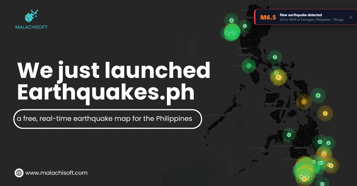
Introducing Earthquakes.ph — a free, real-time Philippine earthquake map, live on one page. Built and maintained by MalachiSoft Inc as a public service.
What it actually does
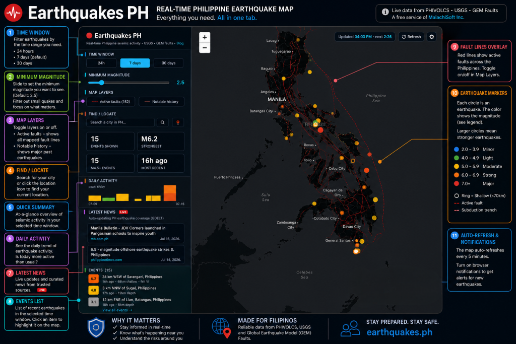
Load earthquakes.ph and you get a live map of every recent Philippine earthquake, plotted at the epicenter, color-coded by magnitude, sized so you can see intensity at a glance. Everything is one tab. No signup. No pop-ups.
The essentials:
🕐 Time window filter — See just the last 24 hours, the past 7 days, or the past 30 days. If you’re panicking after a tremor, 24 hours is your friend.
📊 Magnitude filter — Minimum magnitude slider (starts at 2.5) so you can filter out tiny background quakes (there are more than you’d think) and focus on what actually matters.
🗺️ Active fault lines overlay — Toggle on the fault layer to see where the Philippine Fault, the West Valley Fault, the Cotabato Trench and dozens of others actually run. If you’ve ever wondered “does a fault pass near my house?” — turn this on and look.
🌊 Tsunami-relevant events highlighted — Ocean-based quakes are visually distinct from inland ones so you can quickly see whether the sea’s involved.
📈 Daily activity chart — At a glance: is today unusually active, or is it just normal background rumbling for our country?
🔔 Auto-refresh + optional notifications — The map refreshes every 5 minutes automatically. Turn on browser notifications and we’ll ping you when a new event lands.
📍 “Find near me” — Locate your city, see what’s happened around it, and how far you are from any active fault.
Where the data comes from
We wanted to be transparent about this from day one. Every piece of information on the map is publicly sourced:
- USGS FDSN Event API — Primary earthquake event feed. USGS aggregates data from national seismic networks worldwide (including PHIVOLCS’s contributions), publishes updates within minutes of an event, and provides consistent formatting we could build on.
- GEM Global Active Faults (GeoJSON, from GitHub) — Active fault line geometries, filtered client-side to the Philippines. GEM maintains the most comprehensive open fault database on Earth.
- CARTO dark basemap tiles + OpenStreetMap — The map background and geographic context.
- OpenStreetMap Nominatim — Powers the “find your city” search / geocoding.
- GDELT DOC API — Live earthquake-related news feed for context.
- Browser Geolocation API — Optional “quakes near me” feature that never leaves your device.
One important note: Earthquakes.ph is informational, not an official warning system. For actual advisories, tsunami alerts, and safety guidance, the authoritative source in the Philippines is PHIVOLCS — the Philippine Institute of Volcanology and Seismology. We link to them on every page.
Our job is to make the raw seismic picture fast, beautiful, and easy to read for everyday Filipinos. Their job is to issue the warnings that can save lives during a major event. Different roles, both important, and we’re proud to complement them.
Why we built this
MalachiSoft Inc runs an agency, two training schools, and nine SaaS products. But Earthquakes.ph is different. It doesn’t sell anything. It has no ads. There’s no signup, no email capture, no paid tier. It’s just a tool.
We built it for the same reason we built Calculators.ph and DigitalKids.ph: because the Philippines is our home, and there are gaps in the country’s public digital infrastructure that a small, focused team can quietly fill.
The Philippines sits directly on the Pacific Ring of Fire. We average several thousand earthquakes per year — most too small to feel, some large enough to remind us we live in seismically active geography. Every Filipino deserves a clean, fast, honest way to check what’s happening — without hunting through five browser tabs at exactly the moment they most need clarity.
If Earthquakes.ph saves even a few thousand people that thirty-second panic ritual, we consider the project successful.
Under the hood, for the curious
For fellow builders wondering how it’s put together — this one’s built old-school on purpose:
- Zero framework, zero bundler, zero npm. Just plain HTML5, CSS3, and vanilla JavaScript (ES6+). Every page is a single self-contained .html file. No React, no Vue, no Next.js, no Vite, no build step to break in production.
- One JavaScript library: Leaflet 1.9.4, loaded from the unpkg CDN. It powers the interactive map, markers, popups, and layer toggles. That’s it. No other JS dependency.
- All data fetched client-side, no API keys in the current setup. USGS, GEM, GDELT, Nominatim — all accessed via their public endpoints directly from the browser. Nothing to leak, nothing to rate-limit us on our own infrastructure.
- Browser-native everything else. Web Audio API for the optional new-quake alert beep. Browser Geolocation API for “quakes near me.” Fetch API for data. No polyfills needed for modern browsers.
- Zero personal data collection. No accounts. No analytics that track individuals. No cookies beyond what’s strictly necessary for the map to work.
Why this stack? Because a public-service tool needs to load fast on 2G in a province with no signal — and every framework you add is another thing that can fail when someone opens the page one-handed on their phone after they just felt the ground shake. The best code for this job is the code that isn’t there.
The whole build took a few focused weeks between client projects. If you’re a Filipino developer inspired to build your own public-service tool with a similarly minimal stack, we’re always up for comparing notes.
What’s coming next
We’re actively planning:
- PHIVOLCS intensity overlay — Layering the official intensity reports on top of our USGS-based map so you can see both readings side by side
- Historical mode — Notable Philippine earthquakes (Bohol 2013, Luzon 1990, Moro Gulf 1976) with recurrence context for your area
- Barangay-level intensity crowdsourcing — Report what you felt, help build a real-time citizen intensity map
- English + Tagalog + Cebuano UI — English only for now; local languages are the next priority
- Push notifications for rural areas — SMS or lightweight PWA alerts for regions with limited connectivity
If you have ideas or want to help build any of the above, our blog is at earthquakes.ph/blog and we’re reachable at hello@malachisoft.com.
Try it out
Bookmark Earthquakes.ph. Share it with family. Keep it as a browser tab you can flip to the next time the ground moves.
It’s free, it will always be free, and we’ll keep making it better.
Stay safe, Philippines. 🇵🇭
Earthquakes.ph is a free public service of MalachiSoft Inc, a SEC-registered Philippine corporation operating since 2018. From our studio in Iligan City, we build websites, run SEO and paid ads, deliver AI Visibility and business automation for clients across the US, UK, Canada, Australia and the Philippines — and, occasionally, we build public tools like this one just because our country needs them.

Karl Cesar Padilla
Karl Cesar Padilla is a Web Developer at MalachiSoft with several years of experience in WordPress, Shopify, and custom website development. He specializes in building responsive, user-friendly, and SEO-ready websites that help businesses establish a strong online presence. Throughout his career, Karl has worked on a wide range of projects, from business websites and eCommerce stores to custom web solutions tailored to meet unique client requirements.